It is no secret that advanced technologies have already firmly integrated into the life of the agricultural sector and can simplify the work of farmers, as well as increase productivity at lower costs.
Agriculture is significantly affected by annual climate change, which in turn requires farmers to make important strategic decisions in order to calculate possible risks from damage.
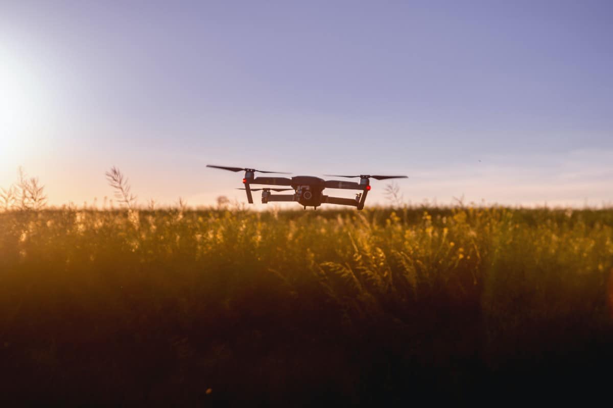
Over the past couple of years, the leaders in the UAV (Unmanned aerial vehicle) market have invested enough in upgrading devices, and now they can work efficiently even in unforeseen weather conditions.
So why do farmers need drones? Everything is very simple: you no longer need to hire individual specialists or do a detour of crops yourself at each stage of crop development.
In less than an hour, drones can scan crops of up to 10 km2. All this can be done even in strong winds or in rainy weather. The cost of an average UAV varies in the range of 30-50 thousand, depending on the manufacturer, model, configuration and purpose.
At first it may seem that this is too expensive an investment, but it is not. With the help of the drone, it is possible to create a 3D map of the farmer’s crops, based on which, throughout the season, it is easy to control their condition. This, in turn, will significantly save costs on material and technical support of the agricultural fleet and plant protection products. All this – without leaving the office.
For several years, drones have successfully taken root in many sectors of the economy and are actively used for both user and military purposes. Meanwhile, agriculture, and in particular precision agriculture, remain the most reliable and sought-after segments for the UAV market.
Thanks to innovative technologies, new software and service offers, farmers have much more tools for productive work than ever before. We can conditionally single out several key models in the drone market. Their variations are constantly being modernized, and each of them occupies its own niche in agricultural production.
Aircraft-type drones are best suited for companies with a large land bank, as they can cover up to 10 times more area than copters. There are also disadvantages: for example, due to the high speed, they cannot fix 3D shooting details.
The most optimal option for small and medium-sized businesses will be the so-called farming drones – they are smaller in size and are relatively cheap. These devices can cover large areas of crops in a short time and identify problem areas in the fields for quick response.
What are farming drones for in agriculture?
Creating crop maps is the main and first task of farming drones. Farming drone flying allows you to create highly accurate maps that define the boundaries of fields, which, by the way, often diverge from cadastral data.
In addition, the entire relief will be visible, its irregularities and objects on the field: forest plantations, shrubs, swamps, etc. Based on these data, it is easier to plan a sowing campaign, taking into account the features of the terrain.
Farming drones can also be used to plant seed material. All the farmer needs is a few batteries, as well as special seed capsules. This type of sowing seeds will significantly save time and money of any farmer who wanted to hire special equipment and personnel.
Another important function is irrigation and application of plant protection products, however, for this we will need special agricultural UAV models equipped with special containers and reservoirs for liquids. Such drones spray water or chemicals several times faster than the traditional method, in addition, they are able to control the amount of application. Again, saving on plant protection and time.
Drones can also monitor crop conditions throughout the season. Such overflights can be done once at each phase of plant development, this will be quite enough. Using special drone sensors during map formation, you can see problem areas of the field that require direct specialist visits. All other crops that are within normal limits do not require additional control.
However, the use of farming drones are not limited to these methods. They are also used in gardening, animal husbandry, filming commercials for agricultural enterprises and the like. It all depends on what kind of drone and why a particular farm needs it.
How can farming drones help farmers?
Using the drone, you can spray fertilizers and protective equipment. Analyze the soil and create maps of fields and crops. Drones in conjunction with software help determine the type of soil, its acidity and topography.
You can track the condition of crops at all stages of maturation. Understand which site and at what time fertilizer or protective equipment is needed. Accordingly – less money to spend, get a better harvest and increase business efficiency.
With the help of drones, it is possible to measure fields, form contours and areas of plots with an accuracy of tens of centimetres. Based on these data, crop rotation can be planned, the budget and the land bank can be optimized.
That is, use every hectare with maximum impact. Drones help farmers understand their land bank, calculate risks, save money, get big crops and introduce accurate farming. In addition, with the help of the drone, you can measure the volume of crops. For example, the amount of grain in warehouses.
Every farmer wants to increase productivity. It is extremely difficult for agronomists to monitor the crops on dozens and hundreds of hectares of fields, and in addition it is important to control the quality of the soil and protect plants from diseases. This is exactly what drones help to cope with.
In order for the drone to process fields with highly concentrated chemicals in small volumes, a map must be integrated into it: according to it, it must understand which plants and how to spray. If the tractor irrigates the fields indiscriminately, then the drone does it point-wise – this is its advantage. On the one hand, less chemicals are spent in this way, which means that economic efficiency is growing.
On the other hand, environmental damage is reduced. With the third – as a result of such processing, plants die out much less frequently.
With the help of the map it was possible to learn more than a person can notice. For this, researchers conducted field experiments for several years:
- Introduced different doses of chemicals at different stages of plant maturation,
- Measured the nitrogen level and monitored the soil condition in the fields,
- Analyzed the information received and created databases.
This is how the technology turned out, with the help of which you can quickly and accurately make an idea of the state of the fields. For example, with the help of such a map you can recognize in which areas there are problems with the terrain, where weeds grow and diseases can develop.
The method is as follows:
- The farmer conducts a survey,
- The fields are circled by farming drones which remove plants and soil.
- The resulting images are transferred to his computer.
- After analysis, determines what happens in the fields, where there is a threat of extinction of plants and what needs to be done to save the crop.
- It is important that the final report is prepared in the most accessible form – in order to understand it, you do not need to have specialized knowledge.
How to set up farming drones
About 90% of farming drones are sold in the Ready to Fly state in the USA, which allows them to be tested immediately. But during the transportation process or after the first launch, the settings may go astray and the farming drone begins to perform chaotic movements, not obey the owner. To correct these violations it is necessary to calibrate the device.
Farming drone flight is based on the acceleration and deceleration of the propellers, which allow you to choose the direction of movement and hover in one place. Stabilization of these actions is carried out on-board computer based on information received from accelerometers and gyroscopes.
Very often, after takeoff, the copter flies away or even loses control. Why does this happen? Because before starting the drone you need to configure it correctly, namely, calibrate the gyroscopes and connect the remote control to the device. And when taking off, you may need to adjust the trim tabs.
The drone is controlled from the control panel, which provides communication between the owner and the on-board computer. With proper setup, the farming drone will easily execute all of these commands.
If you launch a drone in flight without first checking, you can damage or lose the device. Therefore, first calibrate the gyroscope, then check the connection of the device with the control panel. At the last step, trimmers are adjusted to ensure the effect of freezing in the air.
In preparation for the flight you need:
- Insert the battery if it is not built-in.
- Place the copter on a perfectly flat surface.
- Launch the copter.
It is important to observe these points so that the gyroscopes can synchronize. On some models, it may take 10 seconds to turn on and calibrate the gyroscopes. And at this time, the farming drone should be on a flat surface. Then, when taking off, it will not roll to the side, pull, etc.
Connection of the farming drone with the remote control
In different models, the connection of the remote control with the farming drone can be different. Therefore, it is worth looking into the instructions. However, in most cases this process is the same.
If the model is 3-axis, you need to turn on the remote and wait about 7 seconds. Some remotes begin to make repeating sounds. Short sounds mean that the connection did not happen, long sounds – everything went well.
If the model is 6-axis, then you need to turn on the remote control, raise the gas stick as high as possible and lower it down. If the connection is successful, a beep will sound.
Trimer setup
As soon as the farming drone rises a few tens of centimetres above the surface, it is important to understand if it is tending to the side. In this case, gusts of wind should not be taken into account.
If the farming drone still drifts in one direction or another, you need to use the appropriate trimmer. For example, when the drone deviates to the right, you need to press the left trimmer until the drone locks in position.
Reconfiguration of gyroscopes
Reconfiguring gyroscopes is very easy. You just need to land the drone on a flat surface, direct both sticks of gas to the right-down. True, for different models there may be a different combination. The fact that gyroscopes are reconfigured will be reported by LEDs that flash several times. After proper presetting, drone control will be simpler and more convenient.
Farming drone control
If we talk about software products for flight control, it is recommended to use only licensed programs.
Control of the drone occurs through manual control. It is provided with the help of a radio modem, which through an antenna from a ground control station (namely, the control panel) receives a signal with the specified motion parameters (speed and angles) and transmits them to the flight controller.
The necessary components of the complex of the ground control station are a personal computer with Internet access or a 4G modem for autonomous control of the drone and a control panel (or tablet or mobile device) for remote-hand control. Using a personal computer, video processing from a drone is performed, recognition of obstacles and other objects of observation, as well as correction of the flight route.
You can control the drone using special applications. The program allows you to plan complex flight tasks with a few clicks. At the given points of the route, the application will automatically take photos to get accurate maps of the area or video on the specified route. Also, these programs have functions that will not allow UAVs to fly higher and faster than the programmed parameters, thereby increasing flight safety and facilitating the drone control process.
As you know, farming drone setup begins with a test flight, which allows you to determine the trajectory and identify violations. If the drone heels to the right, then you need to adjust the left stick of the joystick, and if left, then right.
Calibrate the aircraft after a test flight in the following ways:
Mechanical – twisting the traction control between the servo drive and the design plate with slight deviations. At low altitude, these violations are not noticeable, but at high altitude they will be noticeable.
Automatic – setting using switches. To set up, you need to conduct a test flight and evaluate the tilt of the drone. After this, you need to set the trimmer to the opposite tilt position. For example, when tilting the drone forward – put the pitch trimmer in the lower position, and when tilting to the right – to the left position.
To move the drone in the horizontal axis, you must use the stick on the right (roll to the side and tilt forward), and the movement along the vertical axis is provided by the stick on the left. A test launch of the drone is carried out in an open area with a minimum number of obstacles. The best option is a free space within a radius of 50 meters. In this case, it is necessary to take into account the wind, which can displace the drone even with the correct calibration.
To correctly configure the farming drone and control it, you need to find out which particular stick causes the violation:
- leaning forward and backward causes the left lever;
- roll to the left and right provides the right stick;
- Tilt and roll – it means you need to calibrate both levers.
Calibration is carried out at a height of more than 50 centimeters, otherwise the flight is carried out by an air cushion formed by screws. It is not possible to identify violations at a given height.
Analysis of information from farming drones
Just flying around a drone sowing – this is only half the work, all data needs to be uploaded and processed. Post processing based on drone surveys has become even easier with the development of special software that allows you to simulate accurate geolocation even when using a tablet or smartphone. There are several processing options.
Cartographic processing consists of a smartphone application and a web platform. The application allows you to plan your flight correctly, as well as automatically synchronize with the drone. After the flight, the data is transferred from the UAV to the computer.
The collected data is uploaded to the web interface, which will process the data and allow you to view and analyze the final result. As a rule, this is a separate geoportal or Google Maps. If we talk about video shooting, when overlaying a track on a video and on a special geoportal, it is possible to trace the full path.
The initial images that the drone takes cannot give a complete picture of the terrain. They are transformed into a stereoscopic three-dimensional image, transmitted to specialists in photo-geometry, load it onto a web platform. Applications and online platforms are not interconnected, so different solutions can be combined.